 NERC Data Catalogue Service
University of Nairobi
Type of resources
Topics
Keywords
Contact for the resource
Provided by
Years
Formats
Representation types
Update frequencies
-

Geological observations during field walks, with coordinates, photographs and descriptions of rocks/geological materials and features at the various stops.
-
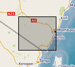
Gro for GooD VES (Vertical Electrical Soundings) Data, Kwale County, Kenya (NERC grant NE/M008894/1)

Results of Vertical Electrical Soundings (VES) study conducted in Kwale County, Kenya in July and August 2017 by University of Nairobi and Water Resources Management Authority as part of the Gro for GooD project (https://upgro.org/consortium/gro-for-good/) to determine the existence of deeper aquifers.
-

Results of Electrical Resistivity Tomography (ERT) conducted in Kwale County, Kenya December 2015 and June 2016 by University of Nairobi and Water Resources Management Authority as part of the Gro for GooD project (https://upgro.org/consortium/gro-for-good/) to characterize the aquifers in the study area. There were eight transects of length 1.2 to 6km, running W-E and NNE-SSW parallel to coastline. ERT data was analysed using RES2D inversion software. Gro for GooD - Groundwater Risk Management for Growth and Development
-
The data comprises of two datasets. The first consists of text files of anonymised transcripts from focus group discussions (FGDs) on livelihood activities, ecosystem services and the prevalent human and animal health problems in irrigated and non-irrigated areas in northeastern Kenya. The second comprises of scores from proportional piling exercises which showed the distribution of wealth categories and livestock species kept. The study was conducted between August and October, 2013 and the data were collected as open-ended meeting notes and audio clips captured using digital recorders. Written/thumb print consent was always obtained from each individual in the group. All the discussions were also recorded, with the participant's permission. Thirteen FGDs were held in the irrigated areas in Bura and Hola, Tana River County involving farmers who grew a variety of crops for subsistence and commercial purposes. The others were held in Ijara and Sangailu, Garissa County inhabited by transhumance pastoralists. Each group comprised of 10 to 12 people and the discussions were guided by a check list. The transcribed documents were formatted in Microsoft Word (2013) and saved as text files in preparation for analysis. The aim of the study was to collate perceptions of land use change and their effects on ecosystem services. The data were collected by enumerators trained by experienced researchers from the University of Nairobi and the International Livestock Research Institute (Kenya). This dataset is part of a wider research project, the Dynamic Drivers of Disease in Africa Consortium (DDDAC). The research was funded by NERC project NE-J001570-1 with support from the Ecosystem Services for Poverty Alleviation Programme (ESPA). Additional funding was provided by the CGIAR Research Program Agriculture for Nutrition and Health. Full details about this dataset can be found at https://doi.org/10.5285/4f569d73-30c5-4b12-bca7-8901fb567594
-
The download .rar file contains a groundwater model of the coastal aquifer in Kwale County, Kenya (ModelMuse Text File) produced by Dr Nuria Ferrer and Dr Albert Folch at the Universitat Politècnica de Catalunya. The model can be used to explore future climate and groundwater abstraction scenarios to provide management recommendations. The download does not include proprietary abstraction data from industry project partners, thus running the model provided here will not reproduce published research findings. The file named”np67IH.bhd” are the initial heads file required to run the model.